Oreti Totara Dune Forest

 Location
Bordering the Oreti River, the reserve lies on the western edge of the suburb of Otatara, about 6km west of Invercargill in Southland. The reserve entrance is on Oreti Road.
Description
Oreti Totara Dune Forest was purchased in 2020 following a successful fundraising campaign. With the COVID-19 pandemic making for some of the most difficult fundraising circumstances we’ve ever had to contend with, we were overwhelmed to receive donations of almost $400,000, helping us raise over $810,000 towards the $1.5 million purchase price of the property. Further funds were successfully raised from a small subdivision, creating seven attractive lifestyle lots on the road frontage. The final reserve area is around 73ha.
The reserve comprises rare native forest remnants that had been depleted by logging followed by years of grazing. We are working with an enthusiastic local Advisory Group to manage the land with the long term goal of restoring farmland to forest over 50 years.
The area is on the east bank of the Oreti River just upstream from its mouth. It is based on a series of consolidated sand dunes and alluvium. The most valuable part of the property, from a conservation perspective, is an area of totara forest on sand dunes, which is a naturally rare ecosystem that is classified as nationally endangered. The property also contains localised areas of matai-pokaka-kahikatea forest. Patches of this kind of ecosystem in the Otatara area are considered the best example of the sand dune totara and totara-matai sequence in New Zealand. This property had been identified as probably the largest remaining unprotected site of its type in Otatara, and possibly even across the whole country.
Flora and Fauna
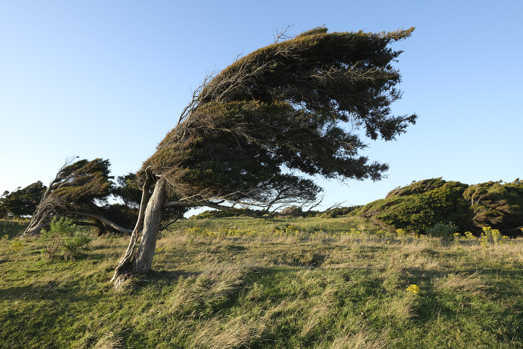
The property comprises about 40ha of totara forest on dunes, but also has areas of ancient matai forest and patches of kahikatea, along with large old manuka and tī kōuka (cabbage trees), rising above extensive areas of mingimingi. There are cosy gullies of open grass and sedges between the totara forest fingers that prefer the drier dune peaks and slopes. Some of the trees are large and have their canopies sculpted into fantastic flag-like shapes by the wind. The cathedral-like matai groves open out to open dunes where you can gaze up the Oreti Estuary towards the distant Takitimu Mountains.
Large groups of pīwakawaka (fantail) may join you on your walk while tūī and korimako (bellbird) regularly call from the totara. The area is expected to host all the common bush birds of the Otatara area, including kererū (New Zealand pigeon), pipipi (brown creeper), tauhou (silvereye) and riroriro (grey warbler). You might also spot flocks of scaup and black swans on the large pond along with heron and stilt feeding in the margins.
Walking Tracks & Facilities
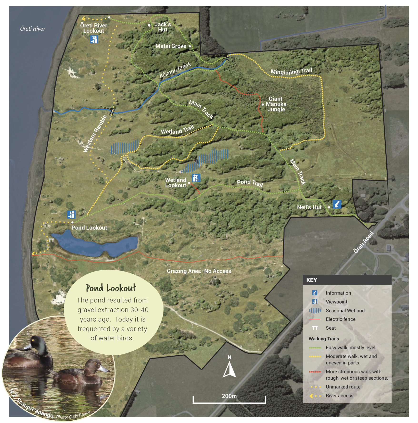
There are several walks as indicated on the map below.
- Green route: Easy walk, mostly level.
- Yellow route: Moderate walk, wet and uneven in parts.
- Red route: More strenuous walk, with rough, wet or steep sections.
Everyone is welcome to visit our reserves, at your own risk. Some hazards inevitably exist in such steep wild terrain. Before you go into the outdoors, tell someone your plans and leave a date to raise the alarm if you haven’t returned.
No dogs are allowed in this wildlife reserve.
No hunting without the express permission of the Native Forest Restoration Trust
Getting There
Get directions: Find out here